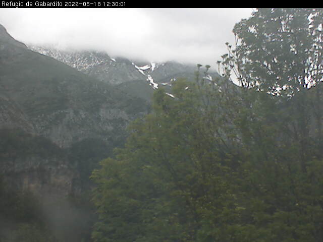
Gabardito - 1360 m
Saber más
Reservas online
Ubicación
Pincha en el icono y accede a la herramienta de cómo llegar de Google Maps
Servicios
- Duchas
- Bar-cafetería
- Taquillas
- Agua caliente
- Servicio de comidas
- Aula polivalente
- Calefacción
- Lugar para cocinar
- Teléfono público
- Mantas
- Calzado de descanso
- Accesible
Otros servicios:
Alojamiento en literas, habitaciones con baño. Terraza. Alquiler de material
Precios
Consultar en la página web del establecimiento
Meteo
Municipio Valle de Hecho
| 17/10/2026 | 18/10/2026 | 19/10/2026 | 20/10/2026 | 21/10/2026 | |
|---|---|---|---|---|---|
| Estado del cielo |  |
 |
 |
 |
 |
| Temp. mín./máx. (°C) | 9°C/ 22°C | 8°C/ 17°C | 8°C/ 15°C | 4°C/ 16°C | 5°C/ 12°C |
| Sen. térm. mín./máx. (°C) | 9°C / 22°C | 4°C / 17°C | 8°C / 15°C | 4°C / 16°C | 5°C / 12°C |
| Prob. precip. | % | 80% | 95% | 65% | 95% |
| Hum. rel. mín./máx. (%) | 65%/70% | 35%/85% | 75%/95% | 40%/85% | 60%/90% |
| Viento | km/h | N 25 km/h | C 0 km/h | O 10 km/h | NO 15 km/h |
Predicción de montaña. Pirineo Aragonés
Elaborado por AEMET con fecha 17/10/2026Válido desde 18/10/2026 hasta 19/10/2026
Estado del cielo
Predominio de cielos muy nubosos o cubiertos, aunque podrán abrirse algunos claros en la Jacetania y Alto Gállego durante las horas centrales. Visibilidad localmente reducida.
Precipitaciones
Débiles o moderadas, siendo más frecuentes e intensas en los macizos orientales, donde podrían ser persistentes. Cota de nieve en descenso, de 2500-2600 a 2000-2200 metros, aunque transitoriamente puede situarse algo más baja.
Tormentas
No se esperan.
Temperaturas
En descenso, notable en las máximas de la mitad oriental. Heladas débiles en cotas altas.
Viento
Del oeste y suroeste en cotas altas, flojo o moderado. Flojo de componente norte girando a este en el resto.
| Temperatura y Sensación Térmica (ST) en (ºC): Min (ST) Max (ST) | |||||
|---|---|---|---|---|---|
| Altitud | T Min | Min (ST) | T Max | Max (ST) | |
| Canfranc | 1160 m | 7 | 4 | 12 | 12 |
| Refugio de Respomuso | 2200 m | 1 | -1 | 5 | 2 |
| Pico Bisaurín | 2670 m | -1 | -6 | 3 | 1 |
| Bielsa | 990 m | 5 | 4 | 14 | 14 |
| Refugio de Góriz | 2215 m | 1 | -1 | 5 | 3 |
| Pico Aneto | 3404 m | -5 | -13 | -2 | -9 |
| Valores previstos en la atmósfera libre | |
|---|---|
| Altitud de la isoterma de 0 ºC en la atmósfera libre | 2800 m |
| Altitud de la isoterma de -10 ºC en la atmósfera libre | 4500 m |
| Viento en atmósfera libre a 1500 metros | N 10 km/h |
| Viento en atmósfera libre a 3000 metros | SW 15 km/h |
Estado de las rutas
Propuestas de actividades
Alojamientos cercanos
- Refugio
- Hotel / Hostal
- Camping
- Centro vacacional
- Albergue
- Casa rural
- Apartamento
Publicaciones recomendadas

Aneto-Maladeta Mapa Excursionista 1:25:000

GR 11 Senda Pirenaica de mar a mar