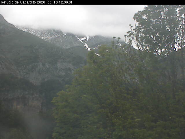
Gabardito - 1360 m
Saber más
Reservas online
Ubicación
Pincha en el icono y accede a la herramienta de cómo llegar de Google Maps
Servicios
- Duchas
- Bar-cafetería
- Taquillas
- Agua caliente
- Servicio de comidas
- Aula polivalente
- Calefacción
- Lugar para cocinar
- Teléfono público
- Mantas
- Calzado de descanso
- Accesible
Otros servicios:
Alojamiento en literas, habitaciones con baño. Terraza. Alquiler de material
Precios
Consultar en la página web del establecimiento
Meteo
Municipio Valle de Hecho
| 18/09/2026 | 19/09/2026 | 20/09/2026 | 21/09/2026 | 22/09/2026 | |
|---|---|---|---|---|---|
| Estado del cielo |  |
|
|
|
|
| Temp. mín./máx. (°C) | 10°C/ 24°C | 11°C/ 27°C | 13°C/ 29°C | 14°C/ 32°C | 13°C/ 33°C |
| Sen. térm. mín./máx. (°C) | 10°C / 24°C | 11°C / 27°C | 13°C / 29°C | 14°C / 32°C | 13°C / 33°C |
| Prob. precip. | 0% | 0% | 0% | 0% | 0% |
| Hum. rel. mín./máx. (%) | 35%/70% | 25%/70% | 25%/60% | 20%/60% | 10%/55% |
| Viento | N 15 km/h | C 0 km/h | O 10 km/h | NE 10 km/h | O 5 km/h |
Predicción de montaña. Pirineo Aragonés
Elaborado por AEMET con fecha 17/09/2026Válido desde 18/09/2026 hasta 19/09/2026
Estado del cielo
Intervalos de nubes bajas en zonas próximas a la divisoria con Francia, que localmente podrían reducir la visibilidad. Poco nuboso o despejado en el resto. Por la tarde crecerán algunas nubes de evolución diurna.
Precipitaciones
No se descartan algunas lluvias débiles en zonas próximas a la divisoria con Francia, preferentemente en la Jacetania, así como algún chubasco vespertino en los macizos orientales.
Tormentas
No se esperan.
Temperaturas
Mínimas con pocos cambios. Máximas en ascenso, generalmente ligero. Heladas débiles matinales en los tresmiles.
Viento
Predominio del flojo de componente norte en cotas altas. En régimen de brisas en el resto.
| Temperatura y Sensación Térmica (ST) en (ºC): Min (ST) Max (ST) | |||||
|---|---|---|---|---|---|
| Altitud | T Min | Min (ST) | T Max | Max (ST) | |
| Canfranc | 1160 m | 10 | 10 | 18 | 18 |
| Refugio de Respomuso | 2200 m | 6 | 4 | 9 | 6 |
| Pico Bisaurín | 2670 m | 4 | 2 | 6 | 5 |
| Bielsa | 990 m | 10 | 10 | 21 | 21 |
| Refugio de Góriz | 2215 m | 6 | 6 | 10 | 10 |
| Pico Aneto | 3404 m | 0 | -2 | 3 | 0 |
| Valores previstos en la atmósfera libre | |
|---|---|
| Altitud de la isoterma de 0 ºC en la atmósfera libre | 3500 m |
| Altitud de la isoterma de -10 ºC en la atmósfera libre | 5500 m |
| Viento en atmósfera libre a 1500 metros | VRB 10 km/h |
| Viento en atmósfera libre a 3000 metros | N 10 km/h |
Estado de las rutas
Propuestas de actividades

GR 11.1 - Etapa 02: OZA - REFUGIO DE LIZARA
Travesía
3
2
3
4
7.50 h.
20.07 km
1.35 km
0.96 km
PR-HU 14: BORDA BISALTICO - ECHO
Ida y Vuelta
3.83 h.
7.20 km
0.03 km
0.20 km
PR-HU 21: SENDA DE LOS GANCHOS
Ida y Vuelta
4.17 h.
8.64 km
0.71 km
0.71 km
GR 65.3.3 - Etapa 1: PUERTO DEL PALO - ECHO
Travesía
7.57 h.
22.99 km
0.44 km
1.54 km
Alojamientos cercanos
- Refugio
- Hotel / Hostal
- Camping
- Centro vacacional
- Albergue
- Casa rural
- Apartamento
Publicaciones recomendadas

Aneto-Maladeta Mapa Excursionista 1:25:000

GR 11 Senda Pirenaica de mar a mar